It is the text from here.
Way of the Kanto contact
With the way (metropolitan area nature walk) of the Kanto contact
"A course of the Kanto contact" is a long-distance nature walk going around Kanto district Tokyo and 6 prefectures by the nickname of the metropolitan area nature walk around. The total extension binds Mount Takao, Okutama, Chichibu, Mount Tsukuba, Kujukuri Beach, Boso, Miura Peninsula, Tanzawa together in Hachioji, Tokyo ume tree flat を origin-destination at 1,799km. It is the way which not only enjoys beautiful Nature, but also can conflict with a rural scenery, history and cultural heritage. 160 courses set the one-day course that was divided into around 10km so that more people use it, and origin-destination connects with a railroad or a bus each.
Chiba is succeeded from Ibaraki in Suigo-ohashi Bridge of Katori-shi, and angry waves of a historic spot and the north total center zone with much Cultural properties and the Pacific are put, and, also, extension about 300km to reach Tokyo Bay through Nature forests and the artificial plantation of the Boso hill, 29 courses are set the shoreline of the bunch.
Way (External link) of the Kanto contact
There is the course by way of Narita, too! It is introduced!
Follow Nature and history; rise
Distance: 11.4 kilometers of time required: 2 hours 55 minutes
The way ground: The Shimousa-Kozaki Station - Jinguji ... fortune temple - comfort temple - Komikado Jinja (Komikado Shrine) - Namegawa Kannon (dragon original hospital) that it is usual
It is the course where a Shinto shrine, the temple where there is many it can be asked while walking in the Nature forests including the white oak forest (Komikado Jinja (Komikado Shrine)) of the prefecture appointed in the Natural monuments of the prefecture's greatest scale.
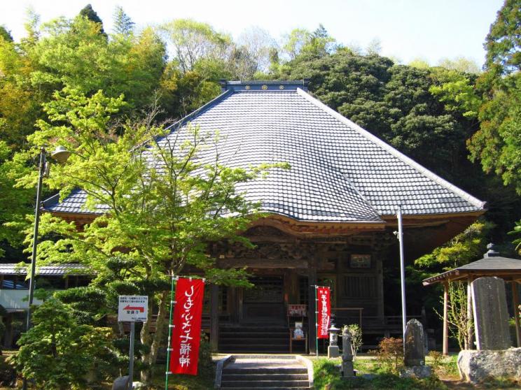
Comfort temple
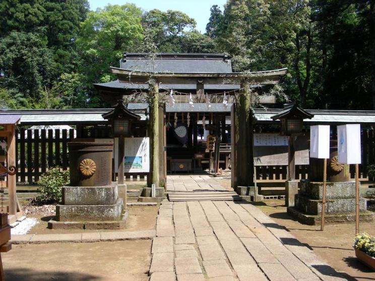
Komikado Jinja (Komikado Shrine)
Follow Nature and history; rise, and a course has a lot; this! (External link)
In quest of an ancient tomb; rise
Distance: 15.2 kilometers of time required: 3 hours 40 minutes
The way ground: Namegawa Kannon (dragon original hospital) - dragon crown - Ryukakuji - Chiba Prefectural Boso-no-Mura (Boso Village) - Shimousa-Manzaki Station
It is the course that can conflict with a rural scenery, history and cultural heritage. The dragon corner temple ancient tomb group where 113 big things and small things gather including Iwaya ancient tomb largest in the whole country where one side is as for 78m can be observed.
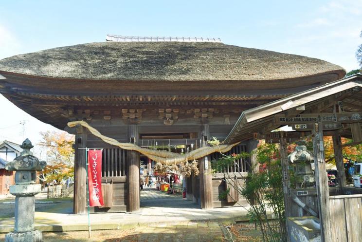
The Namegawa Kannon (dragon original hospital)
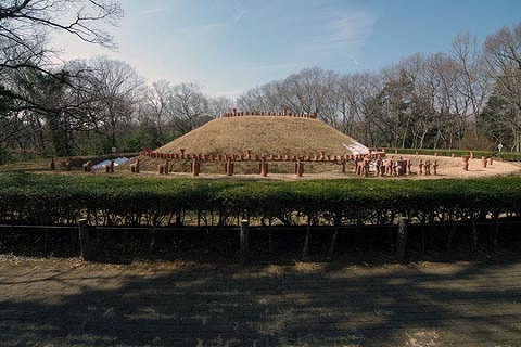
101 号墳
In quest of an ancient tomb; rise, and know a lot; this! (External link)
Of the waterfowl rise
Distance: 5.8 kilometers of time required: 1 hour 30 minutes
The way ground: Shimousa-Manzaki Station - Numahan, Inba (simplified Japanese half-coat drainage weaving shop) - simplified Japanese half-coat handing over trace
It is the course that can explore the scenery in rich Nature such as the Lake Imba of the forest of the simplified Japanese half-coat of "100 selections of Japanese excellent pines" and the prefectural Tega, Inba Nature park. It is the habitat of the waterfowl, and the Lake Imba can observe many wild birds.
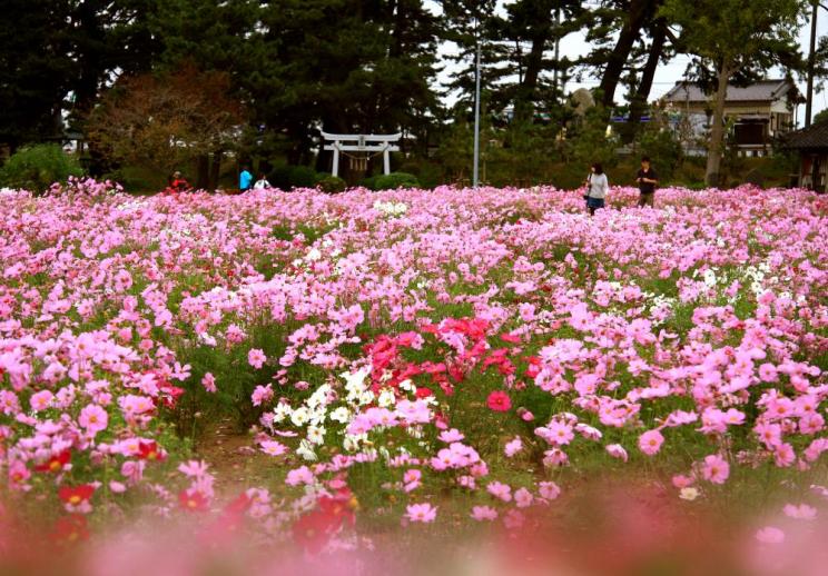
Jinbei Park ※A cosmos does not bloom in 2022. Please be careful.
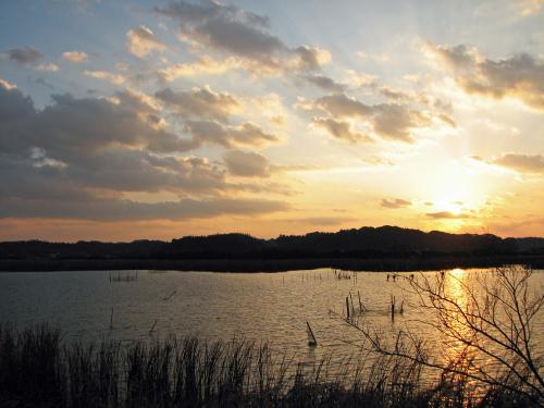
Lake Imba
Of the waterfowl rise, and a course has a lot; this! (External link)
Tie a river and a marsh; rise
Distance: 14.2 kilometers of time required: 3 hours 30 minutes
The way ground: Namegawa Kannon - Tone riverbank (Shinkawa water gate) - Asao - Tanaka God of Fire - Ajiki Station
"It rises in quest of an ancient tomb", and I repeat partly, but と is a course "to rise, and to tie the とあわせて Tone River and Lake Imba to of the marsh circulation" as a branch line course the main line course.
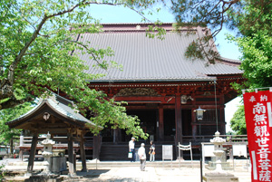
The Namekawa Kannon (dragon original hospital)
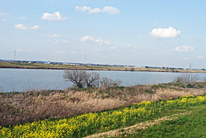
The Tone River
Tie a river and a marsh; rise, and a course has a lot; this! (External link)
Of the visiting marshes rise
Distance: 8.3 kilometers of time required: 2 hours 20 minutes
The way ground: Ajiki Station - Nagato River - Sakanao water gate - Numahan, Inba (the waterfowl rise a junction) - simplified Japanese half-coat handing over trace
Of the branch line course "tie a river and a marsh, rise", and have access to と, and is the main line course; "rise of the waterfowl", and に joins it. It is the course that walks the bank of the Lake Imba while hearing small birdsong.
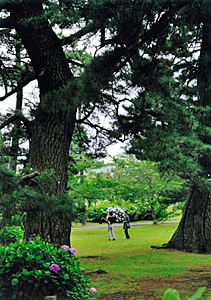
Jinbei Park
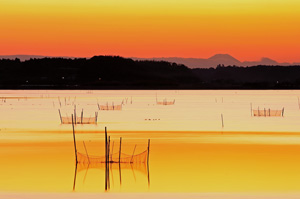
Lake Imba
Of the visiting marshes rise, and a course has a lot; this! (External link)
成田市観光協会 Copyright (C) Narita City Tourism Association. All Rights Reserved.

